
1. Leveraging Early Warning Systems
Understanding the Basics of Early Warnings
When it comes to disaster management, early warning systems are your best friends. These systems can predict natural disasters like floods, hurricanes, and earthquakes before they hit. Imagine knowing a storm is on its way days in advance—how cool is that?
In my experience, the effectiveness of these systems relies heavily on technology. Meteorological satellites, sensors, and even social media can help gather data and relay important information. It’s about connecting the dots so communities can prepare.
However, it’s not enough to just have this technology. It needs to be accurate, trustworthy, and accessible to everyone in the community. If you can’t rely on the system, then what’s the point, right?

Integrating Mobile Technology
In today’s world, nearly everyone has a smartphone, which is super handy in disaster situations. Sending immediate alerts and updates via SMS can reach people wherever they are. I’ve seen towns transform their approach to disaster readiness by tapping into mobile tech for real-time communication. Instantly notifying people can save lives!
Furthermore, apps can provide guidance on evacuation routes, shelters, and safety measures. Imagine getting a push notification that tells you not just to evacuate, but also gives you the fastest route to safety—seriously, that changes everything!
Also, let’s not forget about the importance of community engagement. How you use this tech matters. Conducting workshops to show folks how to use alerts and apps ensures that no one feels left in the dark when disaster strikes.
Thank you for reading this post, don't forget to subscribe NOW for FREE!

Utilizing Social Media Platforms
Social media can be more than just memes and photos of brunch. During disasters, these platforms are powerful tools for real-time updates. I’ve always found it fascinating how Twitter can disseminate information faster than any news outlet during an event. It’s raw, it’s real, and it’s instant.
Many organizations use platforms like Facebook to create community groups for sharing disaster information. That sense of community really shines here. People can share what they see, whether it’s road closures or signs of danger, helping to keep everyone informed.
However, beware of misinformation. It’s crucial to have trained moderators or reliable sources sharing content. The last thing we need during a crisis is to amplify panic through poorly vetted posts!
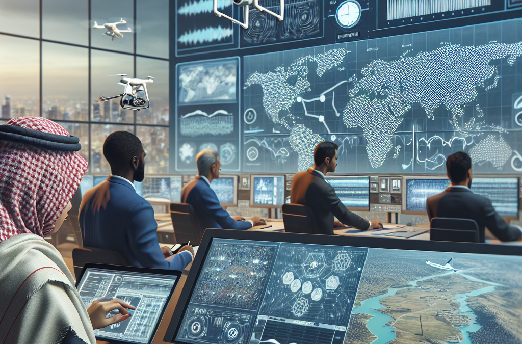
2. Employing Drones for Assessment and Aid Delivery
Improving Situational Awareness
Drones are like the superheroes of disaster response! They can fly over affected areas to provide a bird’s-eye view of the situation, which is invaluable. I’ve seen them survey damage after hurricanes and deliver supplies when roads are blocked.
The beauty of drones lies in their ability to quickly gather data in potentially dangerous areas. This real-time information helps response teams make informed decisions about where to send help first. It’s a game changer in disaster management.
Plus, drones can reach areas that are otherwise inaccessible. Rather than sending people into harm’s way, utilizing drones can keep rescue teams safe while still getting critical information.
Delivering Supplies
When traditional transportation methods are compromised, drones can swoop in to deliver medicine, food, and other essentials. It’s honestly inspiring to see tech being used in such a creative and lifesaving way! I remember a story about a drone delivering insulin to a diabetic patient stranded by floodwaters—talk about technology saving lives.
However, there are challenges to this too. Regulations around airspace can impact drone usage. It’s vital for agencies to navigate these laws while ensuring that this innovation can be used effectively during disasters.
And let’s not discount the potential for collaboration. Some companies are experimenting with logistics partnerships that can streamline supply chains even more, making disaster response faster and more efficient.
Documenting Damage for Insurance and Recovery Aid
After a disaster, the road to recovery can be long and arduous. Drones can help document the damage, providing essential evidence for insurance claims and recovery aid requests. I’ve seen firsthand how having these detailed aerial images helps communities get back on their feet faster.
Creating an accurate record of what happened through drone footage can also help policymakers understand the extent of the damage for future planning. It’s about learning and improving for next time, which is crucial.
That said, it’s crucial to operate within privacy guidelines to ensure respect for affected individuals. Transparency in this process helps alleviate concerns about data misuse. It’s all connected, and we must tread carefully!
3. Implementing Geographic Information Systems (GIS)
Mapping Risk Areas
GIS technology helps visualize data in a way that’s comprehensible, which is why I’m a big fan. By mapping out risk-prone areas, communities can better prepare for disasters. You can’t prepare if you don’t know where the problems might arise, right?
I’ve worked with local governments using GIS to pinpoint flood zones or areas susceptible to earthquakes, which has led to more informed decision-making about evacuations and resource allocation. This kind of planning is a huge asset!
GIS can also continually evolve—tracking changes in demographics, land use, or environmental conditions. Keeping these maps updated actively aids in reducing vulnerability over time in communities.
Enhancing Response Coordination
Another cool feature of GIS is its ability to integrate data from multiple sources. When a disaster hits, the last thing teams need is to operate in silos. Using GIS ensures everyone—from emergency services to public health officials—has access to the same maps and data, facilitating seamless coordination.
During major incidents, I’ve seen how vital it is for teams to have debriefings based on real-time GIS data. It keeps everyone on the same page, literally and figuratively! No more guesswork; we can make decisions based on facts.
This level of collaboration enhances communication and helps avoid duplication of efforts. When resources are limited, efficiency is key. GIS is like a shared brain for responders, making it all work smoother.
Public Education and Training
GIS isn’t just for the authorities; educating the public about it is equally important. Hosting workshops to familiarize community members with maps and data can empower them to make better decisions during emergencies. I love seeing people feel more informed and in control.
Plus, GIS can help communities identify their risks. I’ve participated in programs where citizens map their own neighborhoods, identifying hazards and escape routes. When people understand their own environment, it builds resilience.
Knowledge is power, and I truly believe that understanding the tech behind disaster management can transform how communities prepare and react during emergencies.
4. Fostering Community Resilience with Technology
Creating a Network of Local Leaders
Effective disaster management often depends on strong community ties. By leveraging technology, we can foster a network of local leaders who can help organize efforts during and after a disaster. I’ve seen how groups using platforms like WhatsApp or Slack form instant communication channels—how cool is that?
Gathering local leaders enables each group to cater their response based on their community’s needs. You’ve got experts on the ground who can share intel about resources, which is vital for quick and effective action.
This network also encourages volunteerism. When people are connected, they’re more likely to step up during a disaster—whether that means cooking meals, helping with evacuations, or simply checking in on those who need help.
Utilizing Crowdsourcing for Information Gathering
Crowdsourcing represents an exciting frontier in disaster management. Community members can share real-time information, from road conditions to situations needing immediate assistance. I’ve seen this in action after hurricanes—neighbors posting updates, which helps everyone else plan their next steps.
However, it should be noted that information needs verification. Allowing local leaders or trained volunteers to sift through shared content can maintain the integrity of data while still making it an interactive experience for everyone involved.
Moreover, using dedicated apps for this process can streamline information collection. These apps can guide people on what kind of updates to share and how to report issues effectively—which I think is super helpful!
Engaging in Continuous Training and Drills
Technology can help simulate disaster scenarios for training purposes. For instance, virtual reality offers immersive training experiences without putting anyone at risk. It’s an intriguing way to prep community members for potential events, right? Whenever I see community drills being executed effectively, it’s like a breath of fresh air.
Regular drills using technology allow everyone to practice communication and coordination in a “low-stakes” environment. When disaster actually strikes, everyone feels more prepared and confident, cutting down on panic and confusion.
Let’s be real: practice makes perfect. The more familiar everyone is with response protocols and tech tools, the better they’ll perform when it counts. It’s all about honing those skills over time!
5. Utilizing Mobile Apps for Preparedness and Response
Creating Personalized Emergency Plans
I absolutely love the idea of mobile apps that help individuals create their emergency plans tailored to their needs. These personalized plans can guide users on what to include—like contact info, skills, and resources available in their area. It’s like having your very own digital safety buddy!
Engaging with technology this way encourages proactive measures. For me, knowing I have a plan makes me feel a whole lot better during those uncertain situations. And let’s face it, who doesn’t want to feel prepared when disaster looms, right?
Having an app to turn to takes the weight off shoulders—not just for individuals but for families and communities. This tech can truly empower everyone, giving them the tools to respond effectively.
Keeping Updated with Push Notifications
Apps allow for real-time alerts through notifications, ensuring users know what’s coming and when. I think this feature is a lifesaver! It keeps everyone in the loop about evacuation orders, weather changes, and safety recommendations—it doesn’t get safer than that.
Moreover, notifications can be tailored based on geographic location. If a storm is approaching your area, you can get notified immediately! It’s like having your own emergency siren right in your pocket.
And let’s not forget about accessibility. These apps should cater to various needs, including multiple languages or formats that cater to those with disabilities. Making tech inclusive means more people effectively stay informed and safe.
Building Community via Interactive Platforms
Mobile apps can serve as interactive platforms for communities to engage with each other before, during, and after disasters. I’ve seen apps where neighbors can form groups, share resources, and offer support to one another. This merely strengthens community resilience.
With a sense of belonging in place, people are more likely to share knowledge and offer help when needed. Building that connection is a beautiful thing—but it takes a tech-savvy approach to get it started!
Additionally, encouraging feedback through these platforms helps streamline community efforts. Listening to users allows developers to improve functionality and the overall experience, fostering an engaged community ready to tackle disaster together!
Frequently Asked Questions
1. How can technology improve disaster preparedness?
Technology enhances disaster preparedness by providing real-time information, personalizing emergency plans, and creating effective communication channels. Through mobile apps, individuals can access tailored plans, alerts, and community resources, making them feel more secure and informed.
2. What is the role of drones in disaster management?
Drones play a pivotal role in disaster management by providing aerial assessments, delivering supplies, and documenting damages for recovery. Their ability to gather real-time data helps teams make informed decisions, ensuring timely and effective responses.
3. Why is community engagement important in disaster management?
Community engagement is vital because local knowledge and relationships can significantly enhance response efforts. By utilizing technology to foster collaboration among residents and leaders, the community becomes better prepared and more resilient.
4. What is GIS, and how does it assist in disaster management?
Geographic Information Systems (GIS) help visualize and analyze geographical data. In disaster management, GIS is used to map risk areas, improve response coordination, and enhance community preparedness by providing critical information during emergencies.
5. How can social media be effectively used during a disaster?
Social media can be effectively used during disasters to disseminate real-time updates, share resources, and encourage community support. However, it’s essential to monitor content actively to prevent the spread of misinformation, ensuring reliable information reaches those in need.


